Hilary – Much Ado . . .

by Bob Sparrow

Flooding in Palm Springs area

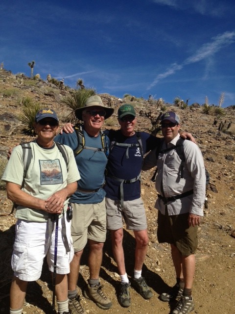
Over this past weekend, while most people in southern California were preparing their homes and yards for the arrival of Hurricane Hilary, we, Mark & Kathy Johnson, Bob & Jeanne Pacelli and Linda & I, headed to San Diego to celebrate the 50th wedding anniversary of the Johnsons, who had rented a beach-front home on Mission Bay.  We were heading right into what was projected to be the teeth of the storm.

Hilary, at the time, was rated a Category 3 hurricane; I looked up the definition:

Winds up to 129 mph!  Devastating damage will occur: well-built framed homes may incur major damage or removal of roof, decking and gable ends.  Many trees will be snapped or uprooted, blocking numerous roads.

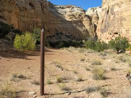
Road to Death Valley

The last time a hurricane of any category hit California was in 1939!  Undaunted, we headed down Interstate 5 to San Diego on Saturday morning and noticed that the freeway was packed . . . going the other way, out of San Diego.  We were clearly going ‘up’ the ‘down’ staircase?  We wondered, is this a smart move?  We concluded, “Ahhh, we’ll be fine.”

Before we left home, we made sure all of our outside furniture/umbrellas were secured or put away.  We did the same at the Mission Bay home on Saturday evening.  We were preparing for the worst, which we were told by local meteorologists that it would be Sunday afternoon through Sunday evening.  By the time we arrived at the beautiful bay-side home, Hilary had been down-graded to a Category 2 hurricane, meaning winds up to 110 miles per hours – still significant!

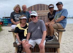
The group weathering the storm at Mission Bay

Once there, we got more news, Hilary had been further downgraded to a Category 1 hurricane, and perhaps just a ‘Tropical Storm’ (winds 65 mph).  It was actually fairly balmy as we sat on our patio and watched volleyball and other various activities on the beach.

We could not have had a better place to watch the storm, in fact, once we got there and parked our car, we never got back into it until four days later when it was time to drive home.  Aside from a great pontoon boat ride, we had two dinners at the Oceana restaurant at the Catamaran Hotel, which was on the beach about 100 yards from our house.

An Oceana Hurricane!

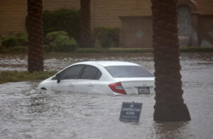
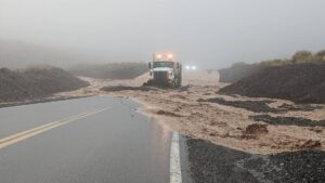
We were getting a light rain most of the day along with mild winds, but nothing extraordinary – we kept waiting for Hilary to hit.  She did finally hit, but it was more of a playful slap than a hit.  Oddly enough, we were disappointed that we weren’t going to experience a once-in-a-generation hurricane/tropical storm in southern California.  As it turnd out, the most ‘catastrophic’ thing that happened was our power went out for an hour or so and we were forced to use a flashlight and candles to play some games at the house until the power came back on.  As it turns out, the deserts and the mountains got hit much worse than any of our coastal cities.  Rain is, indeed, unusual in southern California in August, and the Tropical Storm did cause some major flooding the desert and mountain areas, but it just seemed a little anti-climatic to us on the San Diego coast after all the hype.

As it turned out the closest we got to a hurricane was the one I ordered at the Oceana bar.


Twilight Zone: The Accidental Sea

by Bob Sparrow

Twilight Zone’s Rod Serling

You are in a dimension as vast as space and as timeless as infinity. It is the middle ground between light and shadow, between science and superstition, and it lies between the pit of man’s fears and the summit of his knowledge. A world where your imagination is the only ticket required for passage.  Next stop: The Twilight Zone of Travel.

You’re on a dark, desert highway, cool wind in your hair, warm smell of colitas, rising up through the air.  Up ahead in the distance, you see a shimmering light.  Your head grows heavy and your sight grows dim.  You had to stop . . . but not for the night.

That shimmering light is 50 miles south of Palm Desert in a place that rivals Palm Springs in popularity and draws more visitors than Yosemite.  You are on the desert floor at 223 feet below sea level.

You have arrived at the wonderfully, bazaar Salton Sea.

Salton Sea in the 50s

You are just in time to witness one of boating’s 21 world speed records, as the high salinity makes boats more buoyant and, at more than 200 feet below sea level, barometric pressure improves performance.  Speed boats, water-skiers and fishermen populate this body of water that is larger than Lake Tahoe.  Its shorelines are dotted with beach-front motels, yacht clubs and fancy restaurants.  It is a place that caters to over one million visitors a year, looking to get away and relax in the sun and possibly to invest in what is called the ‘California Riviera’.

You’re at the North Shore Beach & Yacht Club, which just opened the largest marina in southern California, where celebrities including Frank Sinatra, Bing Crosby, the Marx Brothers, Jerry Lewis and Desi Arnaz gather at this Salton Sea beachfront motel.  Your plan is to have some cocktails, a nice dinner and take in a performance by the Beach Boys, who were appearing live that evening.  The only problem . . .

You are 60 years too late!

Shoreline of the Salton Sea today

The North Shore Beach & Yacht Club today

The North Shore Beach & Yacht Club no longer exists.  In fact much of what was built to lure visitors and investors to this area has been ravaged by 120-degree heat, 75 mile per hour winds but mostly by a body of water that was created when the Colorado River breached a dike in 1905, releasing water that became the Salton Sea, an ecological disaster dubbed the ‘Accidental Sea’.

1,000s of dead fish on Salton Sea’s shore

Over the years, due to the heavy alkalinity which causes a lack of oxygen in the water, the sea has become uninhabitable – in fact over 1.7 million fish died in one day . . . yes, in one day.  And if things weren’t bad enough, the Salton Sea sits directly over the San Andreas fault.

Salvation Mountain

If you continued your journey along the east shoreline of the sea, you’ll hit the not-so-bustling town of Niland, population of less than 1,000 – fewer during the summer.  From there, since you’ve already come this far, it’s just a short distance to a must-see attraction – Salvation Mountain.  Constructed by Leonard Knight, who started building the 50 foot mountain in 1984; this masterpiece is resplendent with not only biblical and religious scripture such as the Lord’s Prayer, John 3:16, and the Sinner’s Prayer, but also includes flowers, trees, waterfalls, suns, bluebirds, and many other fascinating and colorful objects.

And just when you thought that things couldn’t get any weirder, you continue east on the road another mile or two and find Slab City, ‘the last lawless place in the United States’.  And you ask yourself, can this ‘last lawless place’ really be that unsafe?  Here’s a quote from one of the residence of ‘The Slab’.

Entrance to Slab City

Slab City Library

“There are definitely some murderers in Slab City, but they would be stupid to do anything here. They might have killed people in the past but they surely won’t do it here, they are hiding. So you could say, this is one of the safest places on earth!”

OK, it’s time to get out of the sun and this Twilight Zone episode.  Thanks for joining my virtual tour; can’t wait to actually go there . . . or NOT!

The Tape Chapter 3 – A Visit with Chief Chuckwalla

(If you have not been following the story of ‘The Tape’ or need a refresher, you can read Chapters 1-2 by going into our archives and looking under ‘January 2014’.)

by Bob Sparrow

While at our timeshare at the Marriott Desert Springs a few weeks back, I decided to take advantage of being near the home of the Cahuilla Indian tribe and follow up on the information given to me by Matt at Chapman University and pay a visit to the tribe. I had contacted Chief Chuckwalla and made arrangements to meet him in a coffee shop in Palm Springs. With The Tape in my hand and Don in my head, I walked into the coffee shop looking for the Chief. I stood at the entrance surveying the small, sparsely populated room when a voice came from my left saying, “Are you looking for a guy in a headdress and war paint?”

chief2

Chief Chuckwalla

Embarrassed that I probably was, I turned to meet Chief Chuckwalla, who was wearing a plaid sports coat.

“Good morning, I’m Bob, we talked on the phone”

“Yes, I’m Chuck”

“Oh, so it’s Chief Walla, your first name is Chuck?

“No, my first name is Mark.”

“So it’s Mark Chuckwalla?”

“No, I just use Chuckwalla because it’s the last remaining Inviatim word left in the English language, so I’m holding on to it. You can call me Chief.”

“So are you the current chief of the Cahuilla tribe?”

“No”

I felt like I was part of the Abbott and Costello Who’s On First routine.

Nonplused, I decided I would try to impress the chief with the fact that I’d done my homework on his tribe, by using a Cahuilla greeting. I smiled and said, “Yee-Makh-weh”

He stared at me just long enough to make it uncomfortable and said, “I think you mean Mee-Yakh-weh, which is how the Inviatim Indian would greet a friend. You, on the other hand, just called me a grapefruit!”

“Sorry.” I guess I never was much good with homework.

I continued, “I notice you use the word Inviatim rather than Cahuilla when you talk about your tribe, why is that?

“Cahuilla is the name that the Spanish gave to our tribe; it would be like calling the Italians ‘Wops’ or the Puerto Ricans ‘Spicks’.

(Don echoed in my head: “How’s this going for you so far, you’ve screwed up his name and now you’ve insulted his entire tribe?”)

I doggedly pressed on, “I don’t know how much Matt told you, but I have a tape that a dear friend sent me years ago in a language or various languages that I’m trying to translate, Matt believed part of it was in the Cahuilla, er Ivia language.”

(Don: “I was wondering when you were going to bring me into the conversation, are you going to tell him that I’m dead?”)

Chief: “Matt has done much to help the Inviatim cause. What is this tape?”

The Tape

The Tape

I held up it up and the chief stared at it

Chief: “Why did your friend send it to you?”

I told him I wasn’t sure.

Chief: “What does your friend say it says?”

(Don: “See I told you you should have told him I was dead!”)

“I actually got the tape in ’95 or ‘96, but when I asked him about it at the time and on several occasions after that, I couldn’t get a straight answer from him, so I just forgot about it. When he passed away a couple of years ago my curiosity was raised again.”

(Don: A couple of years ago, gosh, it just seems like yesterday – where does the time go?”)

The Chief and I sat down in a corner booth where it was relatively quiet and I pulled out my cassette player and popped in The Tape.   We both fell silent as I watched the Chief listen. His expression changed from dutiful to curious to interested, to visibly shaken when he stopped the tape and stared at me trying to decide what to do next.

Finally he stood up from the table and said, “You need to see something.”

shack

Entrance to ‘Sec-he’

I followed him outside and got into his dusty Jeep Wrangler and we headed for the nearby foothills. After a few miles we left the main road for a seldom-traveled dirt road which, after a few more miles, turned into no road at all, until we were deep in the Santa Rosa Mountains. After about twenty minutes, we came to a narrow opening which revealed a boarded up, washed out ranch-style dwelling tucked in the back of a canyon behind an outcropping of granite boulders. As we neared the structure, we passed under a weathered wooden archway entry gate with a name carved in it that was barely legible; as we passed under it I read it aloud: “Sec-he”.

I asked Chief what it meant.

“Sec-he is the name the Inviatim gave to this whole desert area, it means ‘boiling water’; when the Spanish took over they changed the name to ‘Agua Caliente’, meaning ‘hot water’. Then the white man came and decided that neither of those names would help them sell memberships to private golf clubs or luxury homes for celebrities, so they changed the name to Palm Springs”.

Chief drove under the archway and parked the car in the shade of a Palo Verde tree in front of the gray wooden structure. He slowly pushes open the shack2front door that had neither locks nor hardware. The wooden floor creakes beneath our feet as I followed the chief to a small room off the main living area that had only a crude wooden desk and chair sitting on a dingy brown rug. Chief moves the desk and chair off the rug and slides the rug over several feet revealing a trap door. The hinges squeak as he slowly opened it. There is a narrow wooden staircase that leads into darkness. I notice for the first time, a kerosene lantern hanging on the wall next to the trap door, as the Chief pulls it down, lights it and heads down the stairs motioning me to follow.

To be continued  

Chap. 2 The Tape – Searching for Xoon

(Writer’s note: if you missed Chapter 1 you can find it in our archives at the right.  Our free subscription will send our blog to your email every Monday morning.)

by Bob Sparrow

shell     With my thumb and forefinger I fished the shell casing out from the bottom of my shirt pocket and held it in the sunlight coming through my windshield as I sped down Interstate 5 on my way home.  It was the last tangible reminder of my now deceased best friend, given to me after the service by his sister.  The crack of the military rifles still echoed in my ear – a resounding period at the end of his life sentence.

“God dammit Don, why didn’t you take better care of yourself?”

He answered, “Didn’t we always say that ‘life was too long’?”

“It was just a joke!”

“Was it?”

I drove in silence for the next three hours, although it wasn’t exactly silent, in fact my mind was filled with a thousand memories – it was actually quite noisy in there.  I shouldn’t call classical music ‘noise’, but he loved the song Nessun Dorma, we listened to it together as the hair on our arms would stand on end.  Now, as I drive in the vast openness of central California, that melody was haunting me as an ear worm.

Being a rather unsophisticated fan of opera, I would later learn that the song is from the opera, Turandot, by Puccini, Pavarottiwhich ironically, or not, is about solving riddles.  It features an unknown prince, a bitchy princess as well as some torture and beheadings.  Pretty much like operas today, only now they’re prefaced with ‘soap’.  While Nesun Dorma sounds like a beautifully majestic love song, the lyrics and the storyline in the opera are actually quite menacing.  For those not familiar with the song, and even those who are and enjoy a good aria, I’ve attached a link to the 3-minute video of Pavarotti’s offering in 1994 – you may have to copy and paste it into your browser – it’s worth it!

http://www.youtube.com/watch?v=rTFUM4Uh_6Y

     I wondered what all this had to do with anything (as you may be wondering yourself!).  The Tape was already in the car’s cassette player so I just punched ‘Play’.  No longer trying to figure out what was being said, I listened more broadly to the rhythm, the pulse of it.  What I heard for the first time was what clearly sounded like changes in the language being used.  It was still all  unintelligible, but it now seemed clear that the language being used was changing several time throughout the 90-minute tape.

I heard a number of words and phrases repeated throughout the first several minutes.  One such phrase was Eviatem non Cawhoea. I’m sure the spelling here isn’t correct as I just wrote it down phonetically . . . while I was driving.  Of course it meant nothing to me, but I thought about a colleague, Matt, with whom I used to teach and who now was a professor of language at nearby Chapman University, who just might be able to help.

Matt tilted his head towards the cassette player in his office, narrowed his eyes and was motionless as he listened to The Tape.  As the cassette wheels spun I watched his eyes furtively shift, widen then frown.  I silently pointed to the tape, as if to make him listen harder when the Eviatem non Cawhoea part was coming up for the second time.  After it was spoken I clicked off the tape.

“Those words are repeated several times in the first few minutes” I told him, “Any idea what it is?”

“Maybe”, he responded as he turned to the bookshelf behind him and ran his index finger along a row of old books until he found what he was looking for.  He pulled it from the shelf and gingerly laid it on his desk and turned to the page as noted in the Table of Contents.

Pointing at the page he said, “Yes, here it is right here, it is in fact . . . gibberish.”

“Oh thank you esteemed professor of language, I knew you could solve this mystery.  Seriously, does any of it make any sense to you?”

“Actually some of it does.  The phrase, Iviatim non Cahuilla, which is repeated several time probably refers to the Iviatim or Ivia language of an ancient Indian tribe, related to the Aztecs; they’re actually indigenous to the deserts here in Southern California.  Cahuilla, (pronounced kah-wee-ah) was the name for Iviatim that was used by the missionaries and ranchero owners.  It was the Spanish first, then the Mexicans that took over their land.”

“Why did they change the name?  Can you translate any more of it; do you think it tells us why they changed the name?

“Hold on with the questions for a minute.  I’m afraid I can’t translate anything more, that language is nearly extinct; there are probably less than 50 people in the world that can still speak it.  Fortunately for you most of them are out in the Palm Springs area.  Someone out there may be able to answer your questions.”

“Thanks Matt, any ideas on how I would go about finding any of the 50 people that still speak this language?”

“Well, you’re probably not going to find them sitting around the pool at the Marriott sipping a Pina Colada, but I think I can point you in the right direction.”

I would learn later that Matt actually knew exactly where to send me, and he knew why the name was changed, but he had his reasons for not being the one to give me the answers.

Another Walk in the Park: JOSHUA TREE NATIONAL – Part I

Cholla Cactus

Cholla Cactus


by Bob Sparrow

It was all I could do to make a left turn when traveling southeast on Interstate 10 through the Mojave Desert.  The usual right turn takes me into the Palm Spring/Palm Desert communities where for years I’ve gone to relax, play golf and perhaps partake of a margarita, maybe two.  But last week, turning left took me into Joshua Tree National Park where hiking and camping replaced golf and margaritas.  ‘The Boys’ and I planned to camp and spend the weekend hiking just to see what was shakin’ around the San Andreas Fault, which runs through the park.  Even though I’ve lived within two hours of ‘Josh’ (we’re now on a first-name basis), I had never been there.  Apparently I’m not the only one late to this party, Joshua Tree was a mere National Monument (at slightly larger than the state of Rhode Island it was quite a large monument!) until as recently as 1994, when it finally became a National Park.

‘The Boys’ are:

Sparky, Avalanche, Greeter, Trail Boss

Sparky, Avalanche, Greeter, Trail Boss

Patrick ‘Trail Boss’ Michael, who plans the trips, draws the permits, has all the trail maps, plans the menu and   brings the firewood.  He’s an engineer by trade – what a surprise!

  •        – Bob ‘Sparky’ Pacelli, who insists we each carry a walkie-talkie even though we never get more than 20 feet from each other during the entire weekend.  The only time the walkie-talkies were used was when he heard from a trucker on Interstate 10 trying to get lucky.

Rick ‘Greeter’ Sullivan, the friendliest man on the trail; greets everyone he meets with his big, easy smile. If he’s at your campfire make sure you have plenty of wood, ‘cause he’s got plenty of stories.

Richard ‘Chuck Wagon’ Wade, who is not a hiker, but asked if he could come along and cook.  Hell yeah!  Since he’s a forensic doctor with a degree from Harvard, we respectfully call him Dr. Chuck Wagon.

– My nickname is ‘Avalanche’ because I used to come down a hill fairly quickly, that was then, now they’re thinking about changing my name to ‘Lava Floe’ or ‘Petrified Rock’.

Dr. Chuck Wagon

Dr. Chuck Wagon

We entered the park at the Cottonwood Springs entrance, which is at the far southeastern corner; our campsite was at the Black Rock Nature Center, which is at the far northwestern corner, so it allowed us to drive through the middle of the park (about 65 miles), stopping along the way when we found something interesting.

Bra & Shoe Tree

Bra & Shoe Tree

The first interesting site we saw was the rare ‘Bra & Shoe Tree’ (photo left).  Nope, not sure how they got there, but I’d appreciate it if the person who put them there would call my wife and explain – she’s not sure what kind of camping we were doing.

Our first stop was right inside the gate where there is a good long hike (Lost Palms Oasis) and a good short one (Mastodon Peak).  Given that we had ‘miles to go before we sleep’ we took the shorter hike, which took us past the old Mastodon Gold Mine and ultimately to Mastodon Peak which provided us a great view of the Salton Sea and the namesake rock, the one that looks like a mastodon.


Joshua Tree is filled with all kinds of interesting rock formation, many are named after what they look like – Skull Rock, where we stopped to hike

skull rockand have lunch, is a good example. The rock formation in the photo below didn’t have a name that we knew about, so we made up one: ‘Four Frogs Fornicating’ – if you look at it long enough and from just the right angle maybe you’ll see it, but probably not.  I don’t think our name will make it into the National Park Registry.

The road through the park has a good number of pullouts and informational plaques that help explain what lies in front of you, like a beautiful Joshua Trees forest, or a row of those pretty, but prickly cholla cactus or just a collection of interestingly-shaped rocks, many of them with rock climbers on them.

Since ‘Dr. Chuck Wagon’ wasn’t getting in until the next morning, after we got to our campsite and pitched our tent, we decided to go into town for dinner.  Town, in this case was Yucca Valley, although we could have opted for the bustling burg of Twentynine Palms.  We were told about a place just out of Yucca Valley called ‘Pioneertown’, where a movie set of a western town was built in the 40’s and a number of western movie and tv series were shot there staring the likes of Roy Rogers, Gene Autry and the Cisco Kid to name a few.  We had dinner at an old western saloon there called Pappy & Harriet’s.  OK, we weren’t exactly ‘roughing’ it, but we did drive back to the park after dinner and retire to our tent for the night.

Four Frogs Fornicating

Four Frogs Fornicating


Coming on Wednesday – Part II 

                                  Treks to the Lost Horse Mind, Keys View and the Hall of Horrors

The Palm & The Pine – A California Story Part II

     So, what about the trees in the picture?  Glad you asked.  If you travel on Highway 99, which goes north-south through the heart of California, about 10 miles north of Fresno, if you look carefully, drive slowly, very slowly, you will see a palm tree and a pine tree together in the meridian.  Nothing else, no grassy park, no plaques, no mention of this being a landmark, no special entrance, in fact, no entrance at all, just rows and rows of oleanders along the meridian, then the trees, then more oleanders, all protected by the freeway guard rails.  Don’t look for a place to pull over to see the trees, there isn’t one. 

     The history of how the trees got there is fuzzy at best.  Most historians suspect they were put there by agricultural students from Fresno Normal School (now Fresno State University – they had to take the word ‘Normal’ out because . . .  it’s Fresno!), around 1915.   We know they were there before 1926 when Highway 99 was under construction.  It was then workers from the Department of Highways (later to become CalTrans) were ready to cut down the trees to make way for the highway, when a crew member (one of California’s first “tree-huggers”) suggested that the highway go on each side of the trees, which it did.

     I was challenged to take pictures of the trees as I drove by (in both directions . . . several times!) window rolled down, one hand on the wheel, one hand on my camera.  As I checked out the pictures that I’d taken I found that they were all a little blurry.  So to get a good look, or rather a good picture, like the one shown here, one would have to illegally pull off to the side of the highway and hope the CHPs are still back at the Dunkin’ Donut cleaning the contents of a jelly roll from their uniform.  Not to be denied a good picture, I got a bright idea.  On my next trip around I pulled off to the shoulder of the highway across from the trees, popped my hood and pretended to be looking under it (which is a fairly common occurrence on many of my road trips), but really I was taking pictures.  Three people slowed down to offer help, but I gave them a big ‘OK’ sign and they moved on; perhaps they didn’t want to get involved with someone who was seemingly taking a picture of his motor.

     The two trees have special meaning for me.  I was born and raised 28 miles north of ‘The City’ (San Francisco) in Novato, and then a teaching job brought me to what my northern friends call ‘the dark side’ and have now spent the past 40 years in ‘The O.C.’ (Orange County) in southern California; so I feel eminently qualified to ponder and pontificate on the state of the two halves of the state.    I have observed this: If you talk to Northern Californians they may refer disparagingly to a number of things in the south, nothing personal, just things like, “How do you stand . . . ‘all the smog?’, ‘all the traffic?’, ‘all the people?’, ‘all the fake boobs?’ And then add, ‘and stop stealing our water!’.  If you ask Southern Californians about the north and those remarks, they say, ‘Chill dude, whatever . . . wait a minute, what did you say about boobs?’  An objective observer might say the ‘North’ is a little up-tight and the ‘South’ a little too laid back.  As the self-proclaimed expert on these things, I have seen these traits exhibited as well as some other differences, but I actually see so many more similarities that it’s not conceivable to me that the state will ever be divided.  When I think of California I don’t think north and south, I think of things like our beautiful coast line, Yosemite, Lake Tahoe, Palm Springs, the wine country, the San Joaquin Valley, where nearly every crop known to man can be grown.  I think of the creativity in Silicon Valley as well as in Hollywood.  I think of the history of the Missions and of the Gold Rush.  I think of those great writers who lived in and wrote about California, John Steinbeck, Jack London, John Muir, Mark Twain and one of my favorites, Herb Caen, although he had no use for the southern part of the state.  I think of the fact that no matter where you live in California you’re just a few hours (and sometimes just a few minutes) from the mountains, the desert, and the ocean.

     So I think the palm and the pine tree are indeed special, not because they create a ‘border’, but because they’ve existed peacefully, side-by-side for so many years.

EPILOGUE

     The two trees were supposedly planted in the exact middle of the state, but actually they’re about 25 miles off, not sure which way.  Incidentally, the palm tree is a Canary Island Date Palm and the pine tree is not a pine at all, but a Deodar Cedar; neither is indigenous to California, but then most Californians aren’t.  Viva La Difference!