BODIE, BUTTS AND…BENTON

By Suzanne Sparrow Watson

imageWell, judging from the response we got to Bob’s post last week, I’d say his butt is so popular it should have its own Twitter feed.  He continues to do quite well in his recovery but his now-famous derrière is still stuck at home.  So this week you’ll be traveling with me again to the Eastern Sierras.  Last time I wrote about the ghost town of Bodie, which is a state park that has been preserved in a state of “arrested decay”.  Hmmm, sounds like some people I know.  In any event, this week our travels take us to the towns of Benton and Benton Hot Springs.  If you’ve never heard of them, you’re in good company.

No gas or food here

No gas or food here

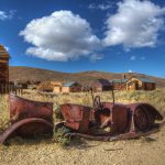
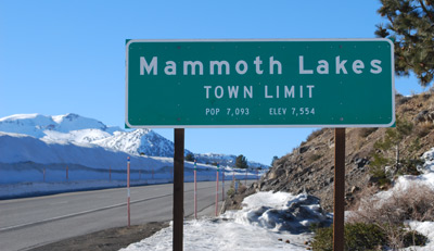
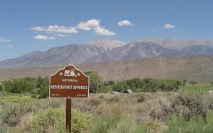
Benton and Benton Hot Springs are on California Highway 6, 32 miles north of Bishop and 46 miles east of Mammoth Lakes.  The towns are three miles apart and are literally in the middle of nowhere.  More on that in a moment.  The “Bentons” were established in 1852 by the Paiute Indian tribe who sought out the warm springs that surround the area.  During the gold rush Benton became a stop-over spot for fortune seekers traveling to and from the western Sierras.  With the discovery of gold in Bodie, Benton became a supply center for the mines and the population swelled to 5,000 people.  The heyday of the towns was from 1862 to 1889 and then, much like Bodie, the gold-seekers moved on to other states and the towns that supported the mines fell on hard times.

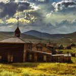
Today, Benton Hot Springs is noted for a rustic bed and breakfast, aptly named The Inn at Benton Hot Springs.  Remember when my brother wrote about the Inn at Spanish Bay?  This is nothing like that.  However, it is a jumping off point for many of the hiking trails in the area and is busy all summer long.  Note that I said it is “rustic” – only one of the rooms has its own bathroom.  The inn gets varying reviews on Yelp from “fabulous” to “flea bitten .  Since sharing a bathroom with a stranger is my idea of Dante’s Inferno, I’m going to pass on the Inn.  But if you want to hike the area it is your best – albeit your only – bet.

It looks innocent enough but...

Hasn’t changed since the ’50’s

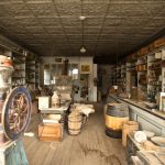
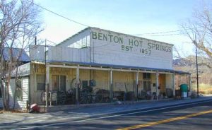
Benton is the real “town” of the two spots, although the current population has dwindled down to 165 hearty souls.  The town’s gathering place is the Benton Station Cafe, which coincidentally is also the gas station, bus stop and post office.  My husband and I have mixed memories of Benton Station.  About 25 years ago on our first trip through the area we decided to stop and use the facilities at the cafe.  It should be noted that Benton Station provides the only bathroom in a 30 mile radius so we assumed they had lots of visitors with urgent needs.  When we walked through the front door everything and everyone came to a standstill.  Every person in the place (and it was packed) stopped talking and turned to look at us as we walked through.  No one said a word to us but they followed our every move.  Images of “Deliverance” raced through our minds.  We scurried to the restrooms, bought a couple of Cokes as a donation, and got the hell out of there.  I have since learned that, like The Inn at Benton Springs, the Benton cafe has widely divergent reviews.  While their pies are rated universally tasty, the food is deemed to be either “best ever” or “sick as a dog for three days”.  It turns out there is a “good” cook and one whose vocational talents lie elsewhere.  The locals have memorized the cafe schedule so they know which days will provide a delicious meal.  After reading that I thought back to the day 25 years ago and surmised that we must have hit the cafe on a day when the “good” cook was working and the locals didn’t want us horning in on the food.
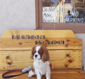
Our wingman

Our wing man

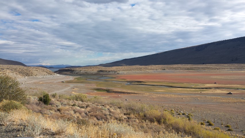
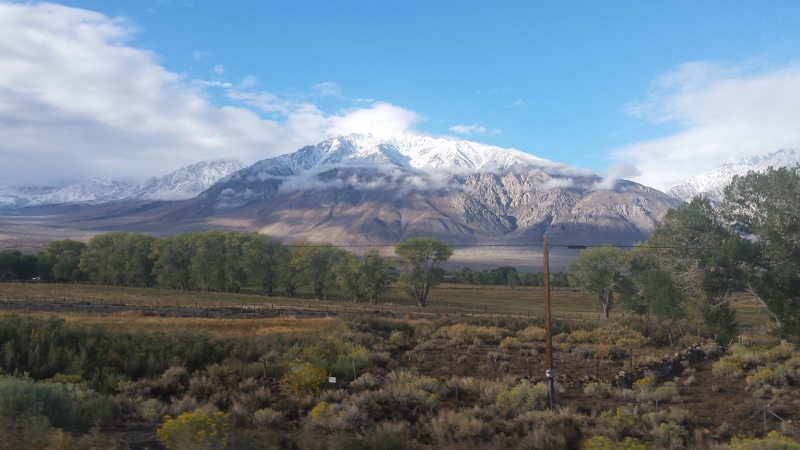
This year we decided to make the trip from Mammoth Lakes out to Benton once again.  Truly, the scenery on the road there is spectacular – a mix of mountains and rolling hills, pines trees and a view of the southern end of Momo Lake.  But knowing that the past can be prelude, we prepared ahead of time for this journey out to Benton.  We brought Dash the Wonder Dog along to act as interference.  After all, the locals might be wary of us, but who can resist the face of a cute dog?


BODIE OR BUST!

By Suzanne Sparrow Watson

The Bodie Car Show

The Bodie Car Show

A friend recently posted a picture of herself in the ghost town of Bodie, California, an abandoned mining town in the Eastern Sierras.  I thought we were the only people crazy enough to take the three mile, pot-holed, kidney-damaging road back to see Bodie so it was good to know we weren’t alone.  Assuming that most of our readers are not crazy (perhaps a rather large assumption) and therefore have not seen Bodie in person I thought I’d fill you in on this little piece of California history.

First of all, part of the reason Bodie is not well known is that it’s in a rather remote part of the country.  It’s just off Highway 395, about 75 miles southeast of Lake Tahoe and 12 miles south of Bridgeport, a town so remote itself that it’s claim to fame is it’s high gas prices.  (As a side note, my husband and I have been playing a game of “name the gas price” for 30 years whenever we approach Bridgeport and we always underestimate). The turnoff to Bodie is easy to miss – there is a small brown “State Park” marker but that’s it.  Bodie is 13 miles east of the turnoff, 10 miles paved and the last three the teeth-jarring surface mentioned above.  In fairness, there is a sign posted warning that the road is not paved the whole way, but given the condition of the road it should say “Turn Back Now if You Value Your Tires and Vertebrae”.

Downtown Bodie

Downtown Bodie

Once you arrive in Bodie you will be transported back in time.  The Bodie Foundation, which now runs Bodie for the State Park system, makes a point in informing visitors that Bodie has not been restored, rather, it’s been preserved in a state of arrested decay.  Walking down the main street in Bodie is the closest you might ever come to experiencing a real mining town.  A town with a storied past and a short lifespan.  In 1859, as the gold rush in the western Sierra slopes began to dry up, miners rushed to the high desert of the eastern slopes in hopes of making their fortunes. W.S. Bodey laid claim to the land around Bodie and then set out to Mono City to get supplies for the town.  Unfortunately, the winter of 1859 was particularly harsh and Mr. Bodey froze to death in a snow storm on his way back to camp.  Nevertheless, others carried on and named the town in his honor – although a sign painter spelled the name phonetically and that’s the spelling that endured.  Some gold was discovered but the town struggled through the 1860’s and early 70’s; by 1868 only two mining companies had been established and that year they both closed.  In 1876, the Standard Company decided to mine Bodie again and discovered a profitable deposit of gold.  Suddenly Bodie was transformed from a has-been mining camp to a boomtown.  More discoveries were made in an adjacent mine in 1878, causing more and more people to seek their fortunes in this remote wilderness.  It’s estimated that in its heyday the population of Bodie was 5,000-7,000 people with more than 2,000 buildings in town.

Bodie had amenities not usually found in a mining camp – a Wells Fargo Bank, several daily newspapers, restaurants, a volunteer fire company and even a brass band.  There was a Chinatown neighborhood with several hundred  inhabitants who had been brought in to work the mines.  And just like in “Gunsmoke”, there was a red light district with their own Miss Kitty – Rosa May.  But what Bodie was best known for was it’s free-wheeling, downright dangerous culture.  There were 65 (!) saloons along the one mile stretch of Main Street.  The cry of miners as they left their hometowns was “Goodbye God, I’m Going to Bodie”.  The town became known for murders, shootouts, barroom brawls, and stagecoach holdups.

The General Store

The General Store

The first signs of Bodie’s decline began in 1880 when silver and gold discoveries in Montana, Arizona and Utah lured the “get-rich-quick” miners to the new boomtowns.   Most of the single men left town and Bodie turned into a family-oriented community.  Despite the population decline, the mines flourished.  A narrow-gauge railroad was built, the Bodie Railway & Lumber Company, bringing much needed lumber, cordwood, and mine timbers to town.  But there was no going back to the boom times.  By 1910 the population was down to 698 people.  In 1912 the last newspaper, The Bodie Miner, shut down and in 1913 the Standard Mining Company finally closed its doors.  In 1917, the Bodie Railway was abandoned and its iron tracks were scrapped. By 1920, the Census Bureau recorded Bodie’s population as 120 people. Despite the decline, Bodie had permanent residents through most of the 20th century, even after a fire ravaged much of the downtown business district in 1932. In fact, the post office operated until 1942, when the federal government required that all nonessential gold mines be shut down to support the war effort.

Just left Bodie

Just left Bodie

Bodie was designated a National Historic Landmark in 1961 and became a California State Park in 1962 when it was named the state’s official gold rush town.  Only a small part of the town has survived, with about 110 structures still standing, including one of the gold mills. You can peer in the windows of the commercial buildings and homes, many remain as they were left – stocked with goods and personal belongings.  Dinner plates on are the tables, food is in the pantry (I’m guessing way past its “best by” date) and cars are abandoned by the roadside.  I think these abandoned items are what most intrigued me.  It’s one thing to decide to leave town, but why did so many leave all of their belongings?  After all, when most of the remaining Bodie residents left it was the height of the Depression, when clothing, food and furniture were in short supply for most.  I’ve read some speculation that most residents just wanted to start over fresh and  gave their belongings to the their friends while some thought they would return for their belongings when things got better at the new gold strike over the next hill. I guess we’ll never know.

Bodie is an attraction not to be missed and if you’re at all interested, make a trip soon.  The cash-strapped California Assembly has had Bodie on the chopping block for several years.  The Bodie Foundation raises money to keep it open but it’s not known how long they can continue to do so.  Just remember, if you go, bring a spare tire and make sure your kidneys are in good shape.


THE DROUGHT AND THE JUNE LAKE LOOP

By Suzanne Sparrow Watson

mammothYes, it’s me again this week.  As you read this my brother is hiking Machu Picchu.  Which means he has no access to the internet.  This could be my opportunity to write something really awful about him, except that he’s a really good guy and right now I’m just hoping he has a really great time.  So instead, I’ll write about my recent trip to June Lake Loop and the ravages of the California drought.

For those of you who live in Southern California you are probably familiar with Mammoth Lakes, a renowned ski town and home of several Olympians.  It is a place that my husband has visited yearly since 1960 and we have been going there together since the mid-80’s.  As someone who grew up going to Lake Tahoe,  I always considered “the Lake” to be the most beautiful mountain retreat in the Sierras.  And truly, it IS spectacular. But there is something about the eastern escarpment of the Sierras around Mammoth Lakes that takes your breath away.  Rather than the gently sloping foothills that you see on the western side, the eastern stretch juts out at a sharp angle from the flat terrain.  Mammoth is also higher than Tahoe – the town sits at about 7800 feet and the top of the mountain (which I have been crazy enough to ski down) is at a staggering 11,000 ft.

The Aptly named "Oh" Ridge

The Aptly named “Oh” Ridge

When we travel there in the summer we usually make a point of driving the June Lake Loop, a five-mile stretch of Highway 158 that is approximately mid-way between Mammoth Lakes and Lee Vining.  The loop is literally a horseshoe-shaped road that sits between the eastern Sierras and the four lakes that rim the road: June, Gull, Silver and Grant. Six hundred and twenty-nine brave souls live along the shores of the loop as permanent residents, but the population swells to thousands during the summer and fall.  It is the ideal place for fisherman, backpackers and day hikers.  They also have added a new spa which is attractive to people like me who leave their siblings to do the “outdoor” stuff.  This year we made the trip again, partly to see how the drought had affected one of our favorite spots.  As we entered Highway 158 coming north from Mammoth Lakes the first site we came is Oh! Ridge.  As you can see from the picture (right) the ridge earned its name.  I can’t remember a time when upon coming to that point I didn’t say “OH!”.  This picture was taken from my car window as my husband was trying to avoid the jerk driver behind us who was tailgating.  So you can imagine just how gorgeous the picture would be if we had actually stopped.  Still, you get the idea.  Although we had been reading a lot about the California drought, and June Lake was definitely down from previous years, it still looked pretty good.  A bit past the ridge we entered the village of June Lake, the hub of the loop.  It is where most of the population lives, where the businesses are and is adjacent to the June Mountain ski area, a favorite of locals.  There are several good little motels and best of all, an ice cream store.

Gull Lake is a litter harder to see from the roadway but sports its own marina and is a great place for fishing.  A mile down the road is the beautiful Silver Lake.  It is situated such that it often has a reflection of the mountain on the water and is another breathtaking site.  Unfortunately we were there on a cloudy day so it wasn’t showing its best side to us but is beautiful none the less.  I always have a soft spot in my heart for the only business on the lake, the Silver Lake Resort and Café.  It has been in business since the 1920’s, making it one of the oldest recreation resorts in the Sierras.  Make no mistake, “resort” is stretching the term a bit.  It is the type of place that sells everything from tee shirts to fishing lures at the check-out counter.  But back in the late 80’s when we embarked on this trip I had had a few too many…coffees.  There wasn’t a proprietor in June Lake who would let me use a restroom.  But the kind owners of the Silver Lake Resort saved the day, and my bladder, and I will always be grateful.  Again, Silver Lake looked a bit recessed but not alarmingly so.

The depleted Grant Lake

The depleted Grant Lake

The last lake on the loop is Grant Lake, by far the largest of the four.  It serves as part of the Los Angeles Aqueduct so its level is constantly changing depending on how much water is being sucked out of it to head south.  Given the relatively good conditions at June and Silver Lakes we were not prepared for what we saw as we rounded the bend and Grant came into view.  While the photo I took (left) shows some beautiful colors, I quickly realized that I was looking at brush and other flora that used to be underwater.  Trucks and boats were parked on its shores where water used to be.    The marina, which previously sat at the center point of the shoreline is now at its most northern edge.  After spending much of our summer traveling California this was the first time we came face to face with the ravages of the drought.

Snow!

Snow in October!

We left “the Loop” and headed north to Lee Vining to see what Mono Lake looked like.  In past years when the water is low the two islands in the middle of the lake seem to be attached.  As Mono came into view it was clear that not only were the two islands seemingly connected, you could walk from one to the other without so much as getting your toes wet.  We headed back to Mammoth Lakes very depressed by what we had seen.  I’m not sure there’s enough water conservation techniques in the world that can bring Grant and Mono Lakes back up to normal levels.  The weather nerds are predicting a record-breaking El Nino this year and I sure hope they are right.  I won’t mind cancelling a few plans if it means the Sierras get dumped with snow. 

The next day, perhaps a portent of things to come, it started to rain.  The following morning we awoke to snow on the mountaintops.  We can only hope there is much more on the way.